CLIENT
Industry
services & TECHNOLOGIES
Duration

Through a full data audit and a custom-built planning platform, Bordeaux Euratlantique now manages its financial, geographic, and temporal data in real time, improving decision-making across all departments.
Bordeaux Euratlantique, a public urban development agency (EPA), is leading the transformation of the Saint-Jean, Belcier and Rive Droite districts of Bordeaux. To manage this large-scale effort, the agency needed a better way to anticipate, coordinate, and monitor the progress of its projects in real time. 10h11 conducted a full audit of the agency’s data flows and internal processes across all departments, to understand their constraints and needs. Based on this groundwork, we designed and delivered a comprehensive platform that centralizes all key data: financial projections, land management, timelines, geographic zoning, and project status. With editable maps, live dashboards, and cross-functional data views, Bordeaux Euratlantique now has a tailored tool to plan, monitor, and steer its urban renewal strategy with greater clarity and precision.

The need
Bordeaux Euratlantique needed a way to better anticipate and manage its urban development projects, which span multiple districts, time horizons, and departments.The existing systems lacked integration, making it difficult to align financial projections, timelines, and operational follow-up: especially at the scale of an entire city district.
The solution
We began with a full-scale data audit involving every department of the agency, from finance to urban planning to operations.
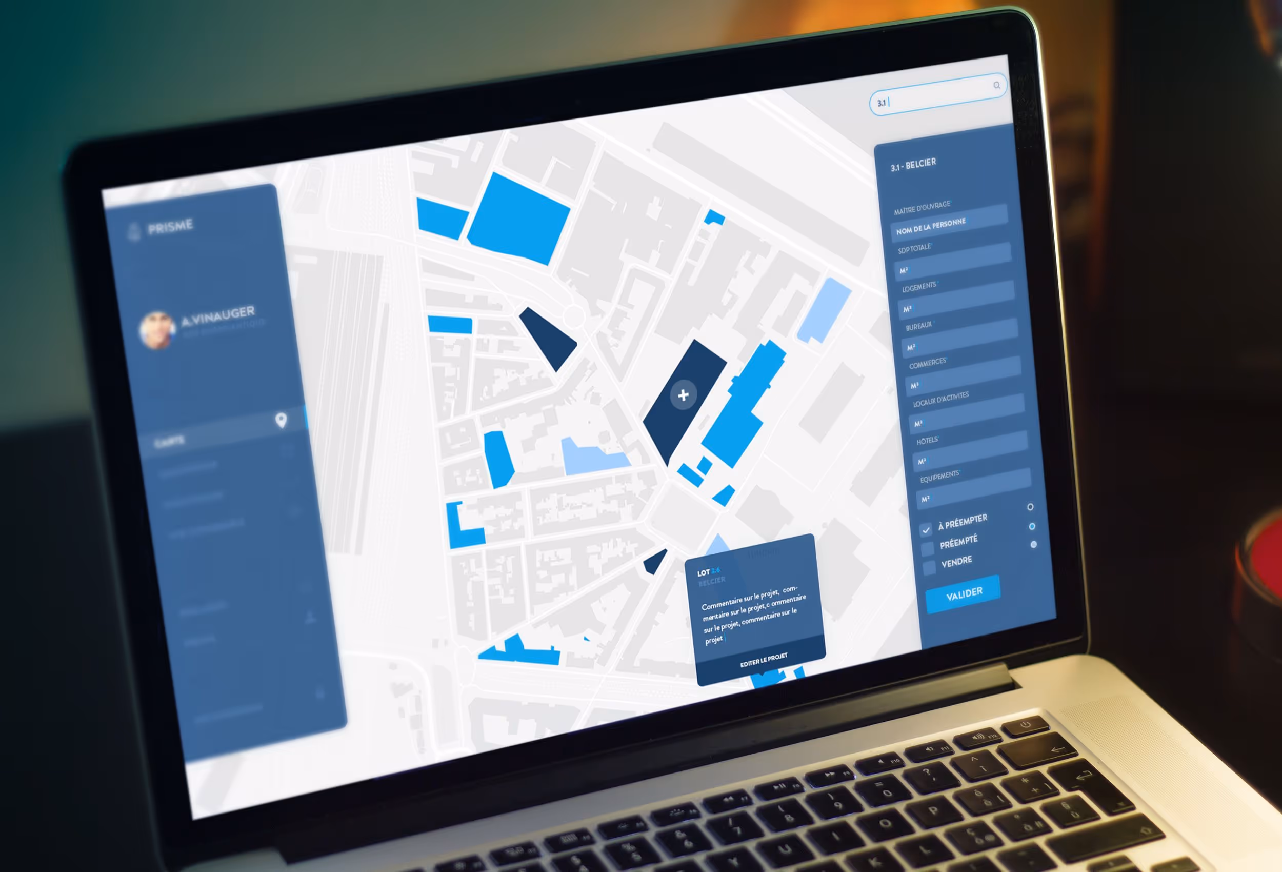
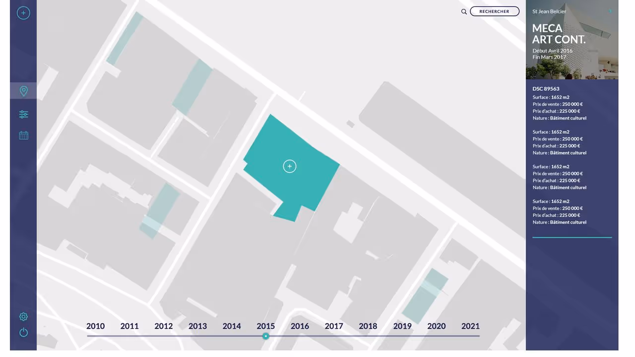
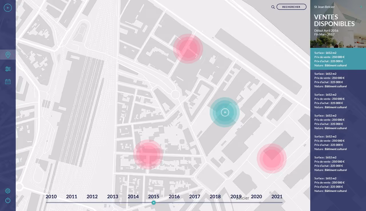
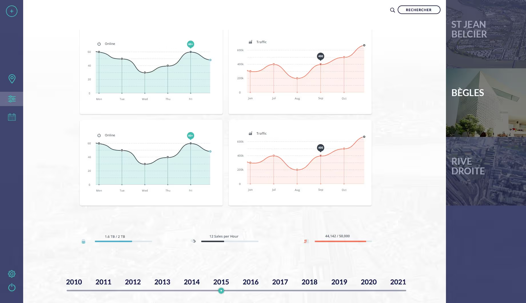
We then built a custom platform centralizing:
- Project timelines (planned, ongoing, upcoming)
- Budget forecasts vs. real-time status
- Editable maps by zone, with real estate availability
- Building types by availability and project phase
- Project tracking by parcels with advisory notes
- District-level statistics and KPIs
- Cross-service data aggregation
This platform gives each team a consistent, unified view of projects, adapted to their operational needs.
The outcome
The EPA now benefits from real-time visibility across all strategic areas: budgets, planning, land usage, and team coordination.This custom-built platform has strengthened the agency’s ability to plan proactively, align internal stakeholders, and better serve the city’s development goals, with a unified, data-centric approach to urban transformation.