CLIENT
Industry
services & TECHNOLOGIES
Duration

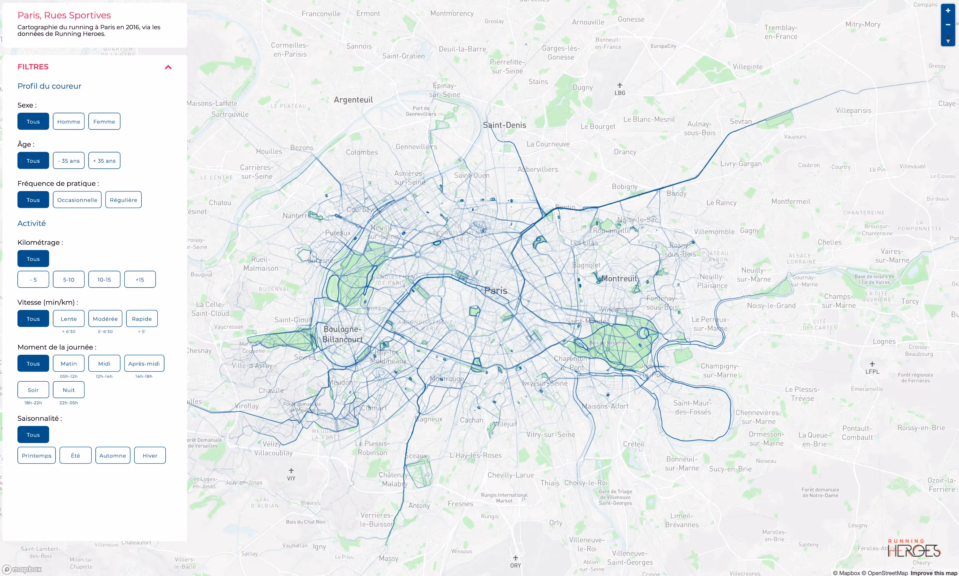
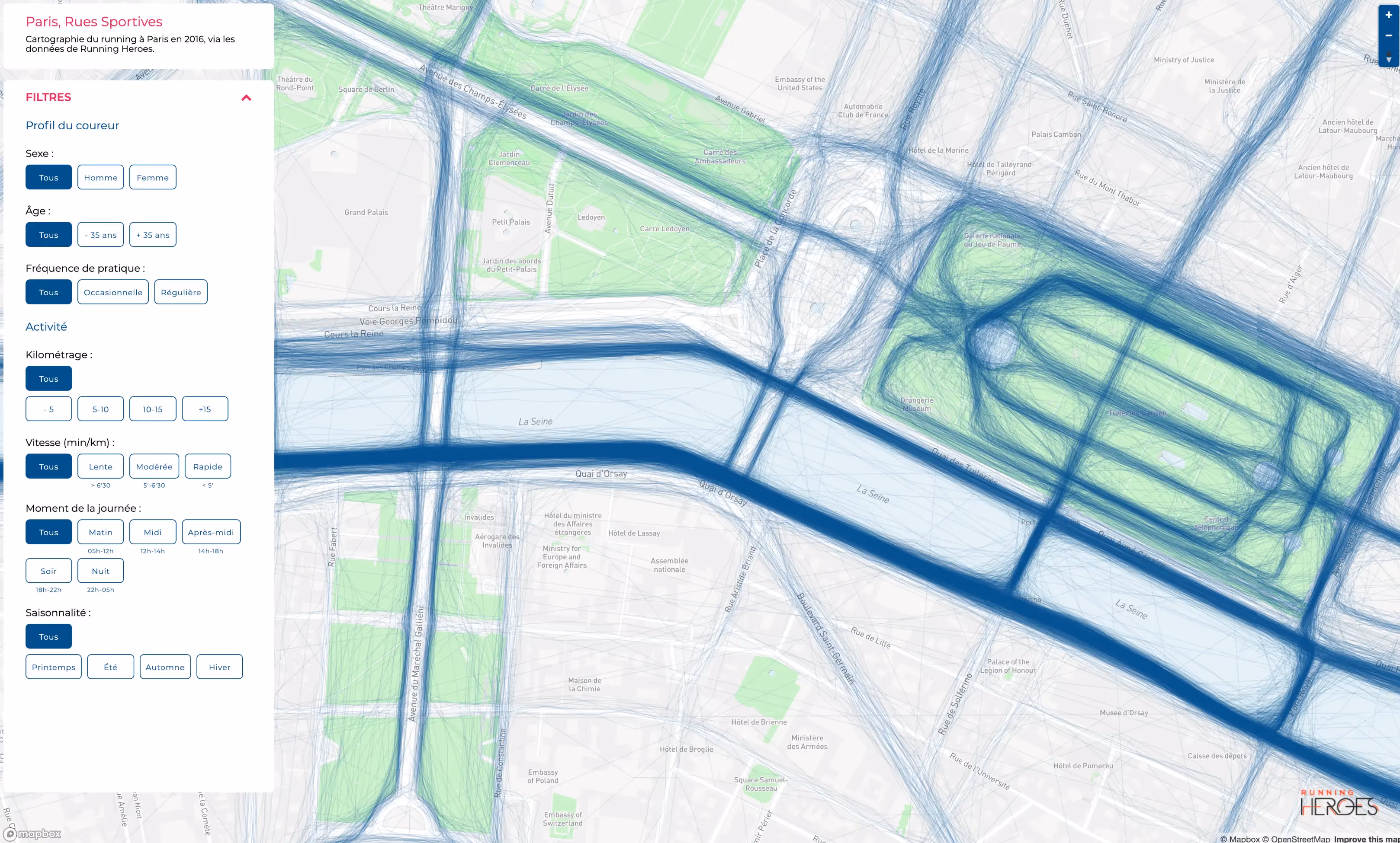
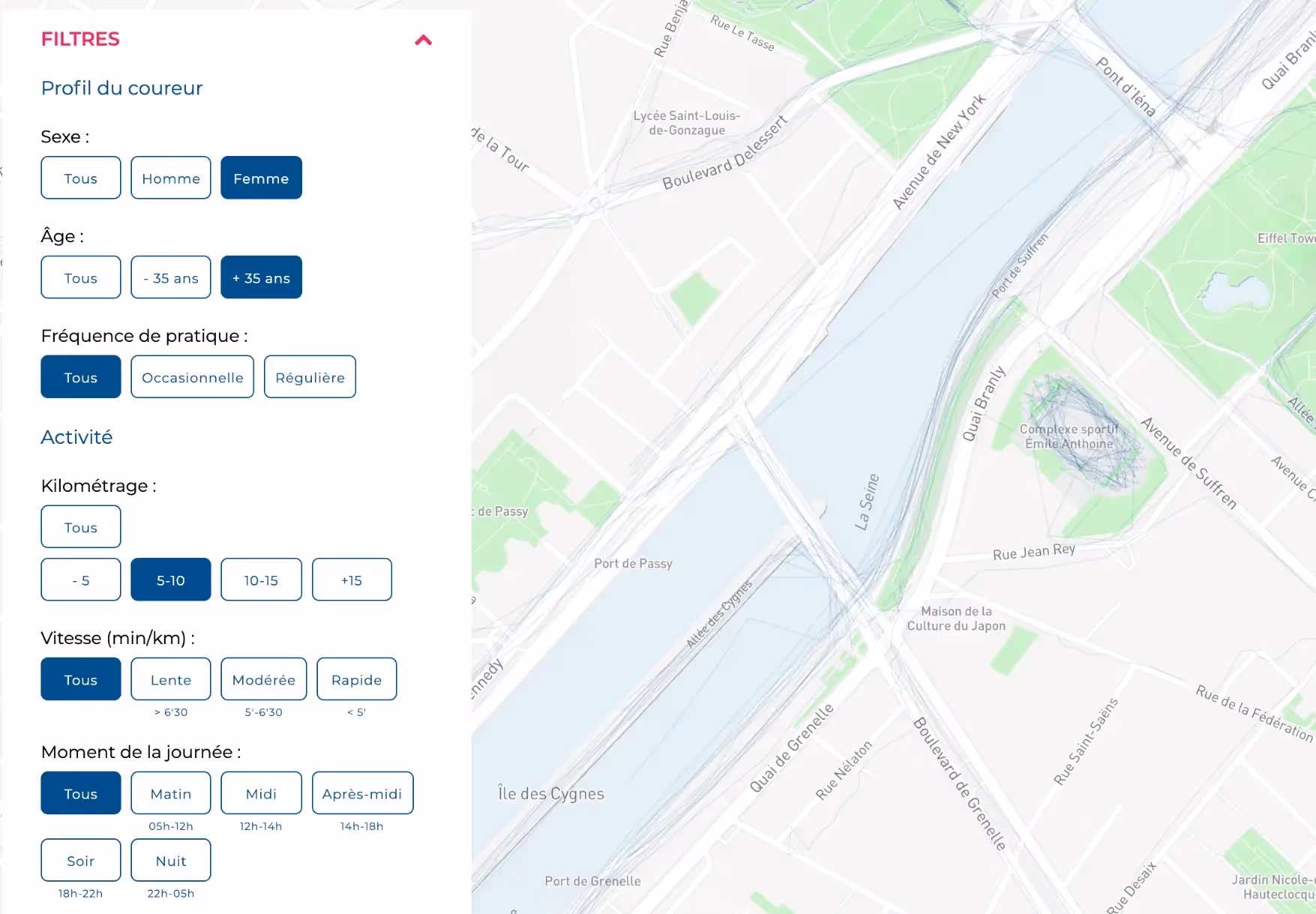
With terabytes of anonymized GPS data from Running Heroes, the City of Paris now visualizes the habits of local runners to better plan its urban infrastructure.
The City of Paris aimed to better understand how its citizens use public space for running — and to adapt its infrastructure accordingly. In collaboration with the mobile app Running Heroes, 10h11 designed a fully interactive map powered by several terabytes of geolocation data. This dynamic data visualization shows aggregated and anonymized running routes across the capital, offering deep insights into how Parisians move through their city. Thanks to a refined system of filters and data cross-referencing, Paris now has a powerful decision-making tool to inform future infrastructure planning for public health, sport, and mobility.

The need
The City of Paris wanted to create a clear, accessible view of how amateur runners navigate the city.The goal: better anticipate infrastructure needs for fitness and urban planning, while using real citizen behavior as the foundation.
The solution
By partnering with Running Heroes, we integrated several terabytes of running data into an interactive web-based map.
The system includes full data anonymization, powerful filtering by time, location, and usage density, and a fluid interface for public and internal use.
The outcome
Paris now has a strategic visual tool to support infrastructure decisions, based on real, large-scale usage patterns.The project combines transparency, citizen data, and public service — all in one intuitive, high-impact dashboard.