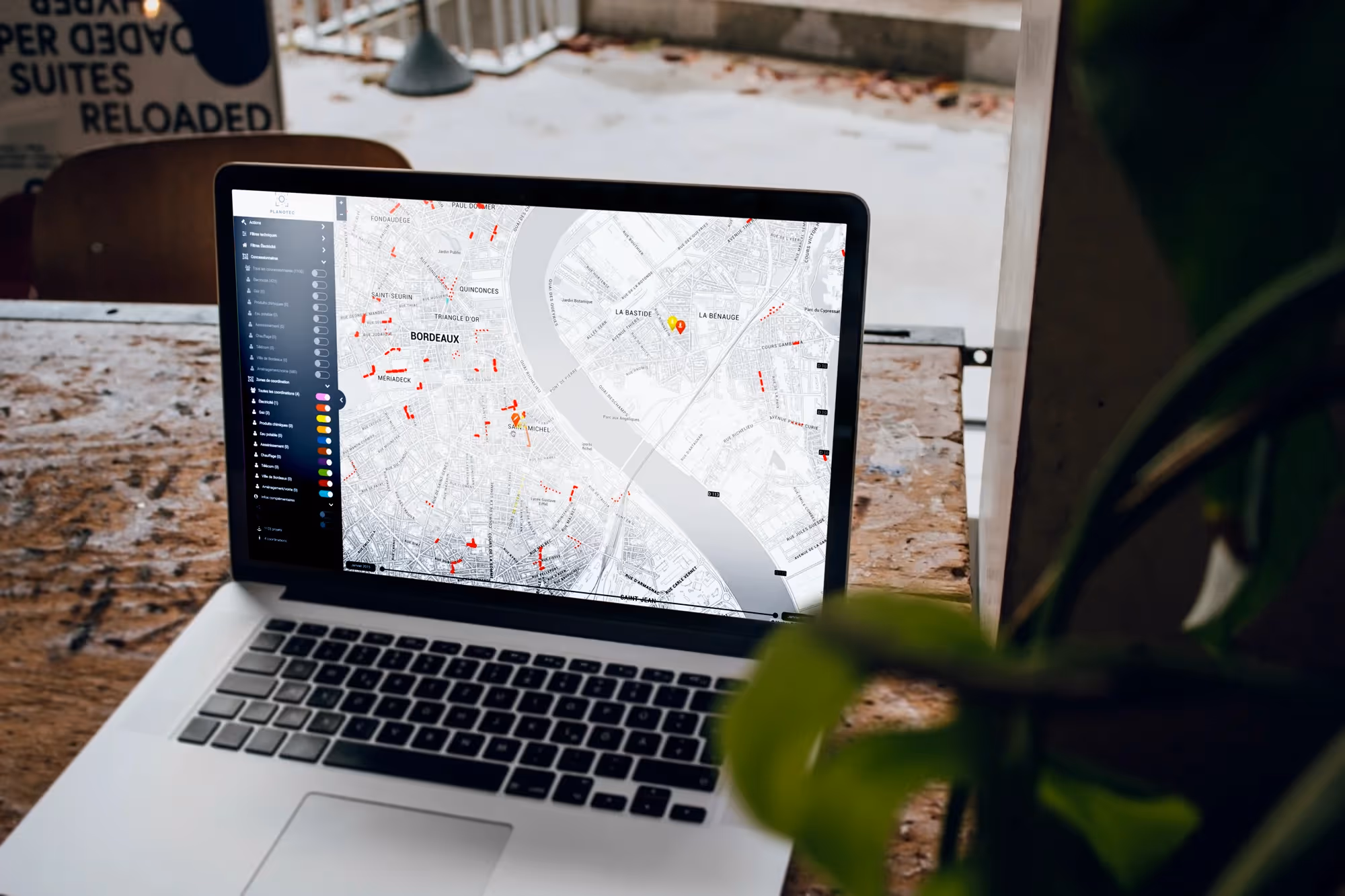

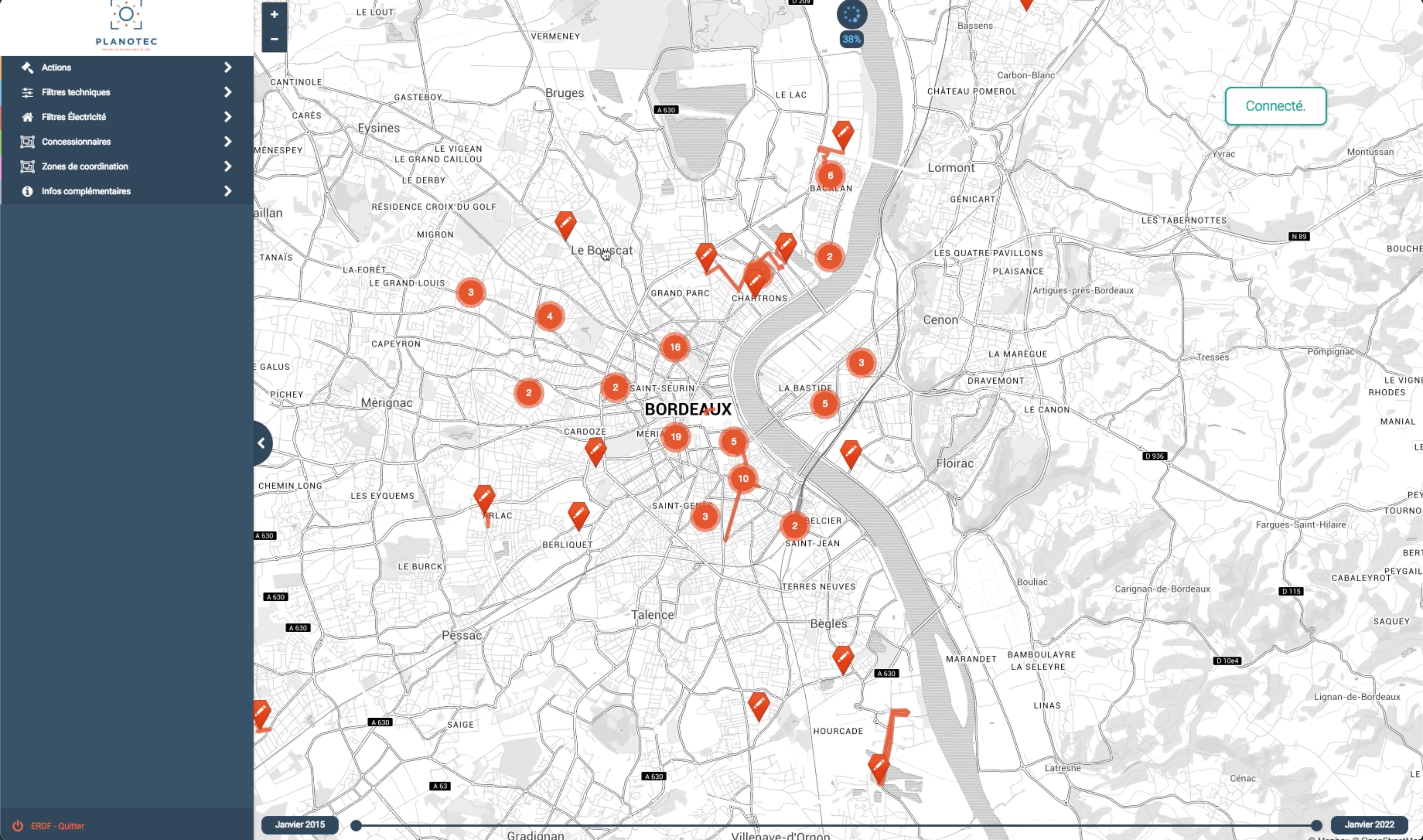
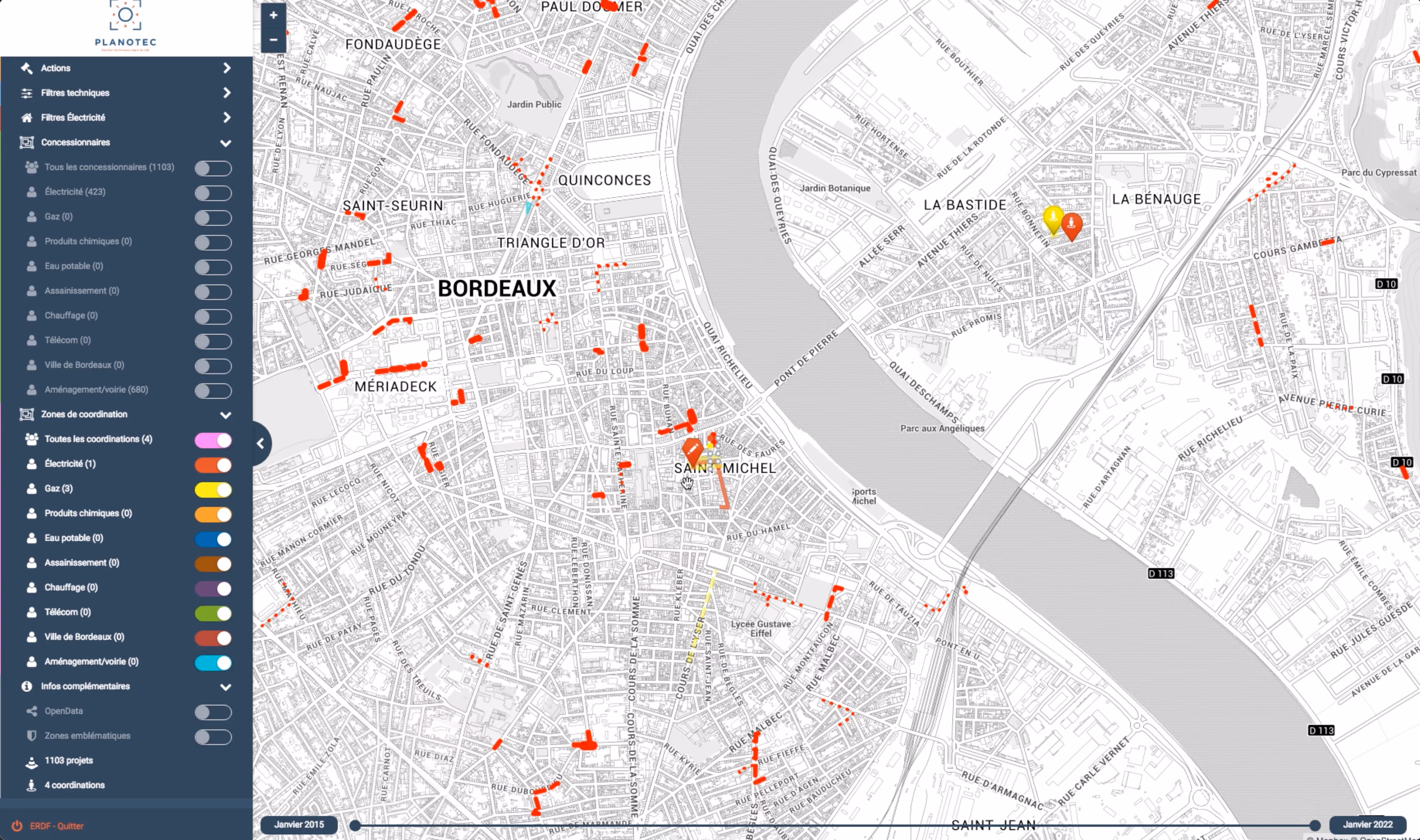
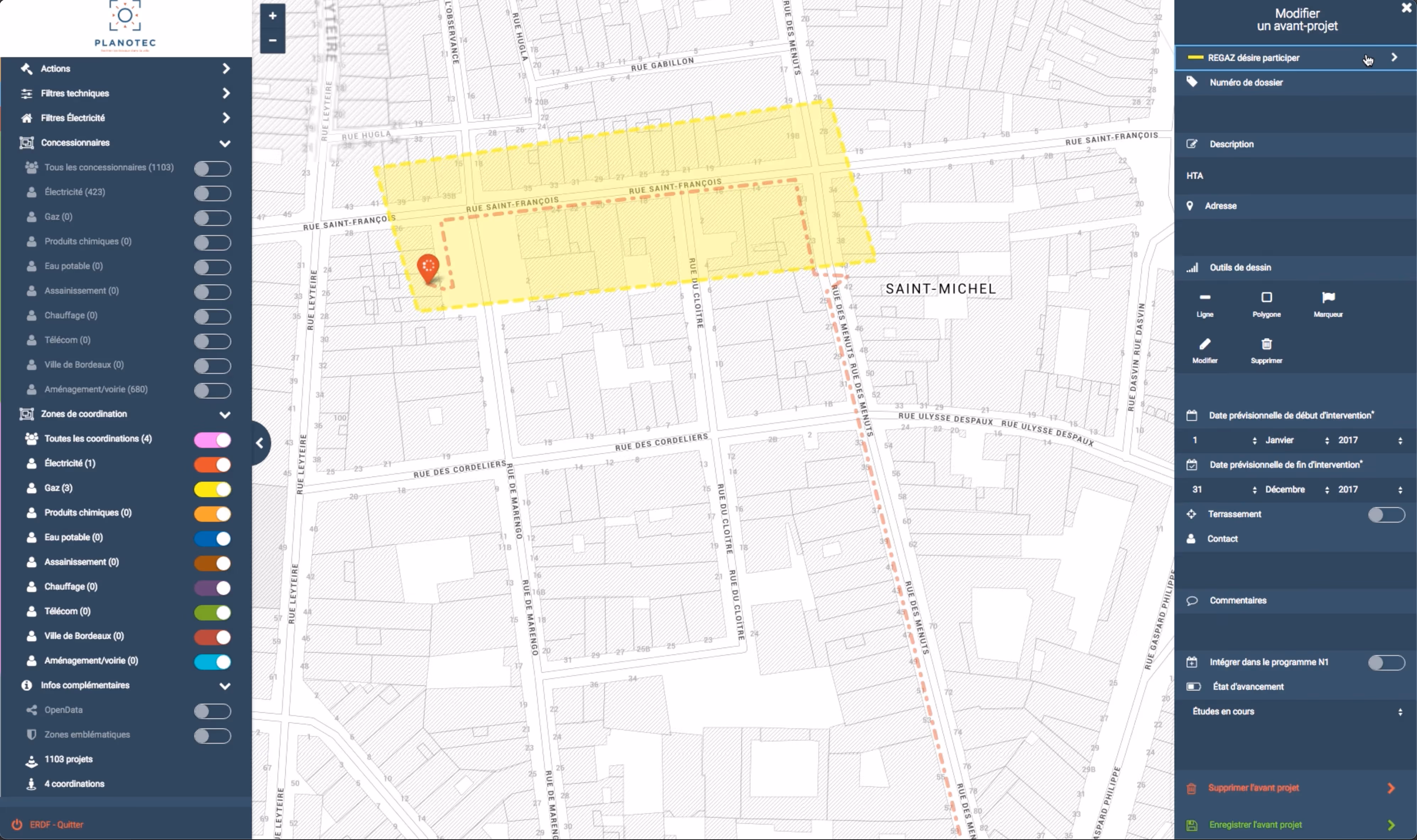
10h11 designed an innovative geographic information system for Enedis allowing the coordination of operators and the optimization of road interventions.
Reducing the costs and nuisances associated with road works represents a major challenge for operators. Our collaboration with Enedis transforms this complexity into an opportunity for optimization.

The need
The company was facing three major challenges:
- Multiple uncoordinated interventions
- Fragmentation of data between operators
- High intervention costs
The solution
Our platform integrates:
- A centralized collaborative planning system
- A unified visualization of networks
- Tools of Business Process Automation
The outcome
The transformation generated:
- Substantial savings on intervention costs
- A reduction in urban disturbances
- Better inter-operator coordination
This innovation illustrates how a collaborative approach based on Data engineering can optimize the management of urban infrastructure while reducing operational costs.

No items found.